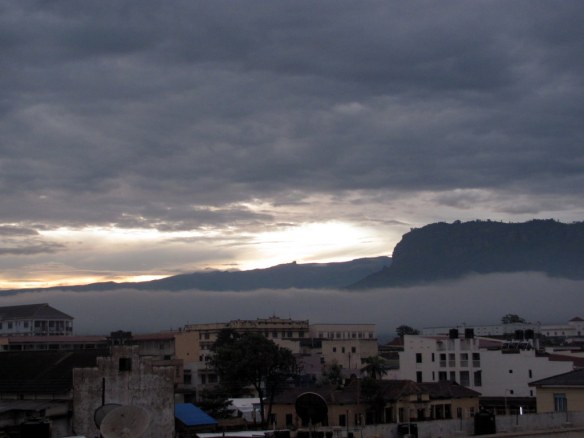
Early morning view of the mountain range from Mbale town, as I pack my bag to set out for the four-day trek.
Mountains are my favourite scenery. There’s something incredibly beautiful about the intersection of fast-moving clouds, gigantic rocky towers, and bright blue sky.

Our guides, park rangers Jasper and Alex. After an hour or so of hiking, we had reached the edge of Mt. Elgon park.
I went looking to take my breath away on Mt. Elgon, a national park on the border of Kenya and Uganda. After organizing porters, guides, tents, sleeping bags, and food in the town of Mbale, my hiking companion and I started the four-day hike.

First hour and going strong, as we march uphill through farmland. The views were already impressing me, with many hours yet to hike.
It was rainy season in East Africa, and Mt. Elgon has a well-earned reputation for being a very wet mountain. One of our guides told me that the heavy rains that stream down these rocks provide much of the water for the Nile River and Lake Victoria.
We began steadily climbing through farmland a little ways from the park boundary, at a height of 1,700 metres above sea level. Once inside the park, we twice interrupted local residents cutting down trees, which is allowed only on two days per week. They quickly dropped their bundles of bamboo and disappeared into the forest at the sight of our armed guides/park rangers.
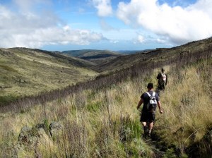
After lots of steep hills, we had climbed through several of the mountains vegetation zones: rolling countryside, rain forest with tall, thick trees, sunny thickets of bamboo, and then Elgon’s alpine heath, with scraggly trees and yellow grass.
Up here, the path became more of a stream and we edged our way along the driest side. My shoes were still soon wet, and the rest of me soon followed when, unsurprisingly, the rain began. it was a damp,chilly night at a sheltered camp site at 3,500 m elevation.

A lookout spot where we rested. You can see how many people live on the foothills leading up to the mountain; I don’t think they often make the long walk down to town.

Jackson Summit, getting closer, but first we headed for Wagagai Peak, the highest part of the Mt. Elgon range.
Day 2 found us walking shortly after 7 a.m. towards Wagagai Peak (4,321 m) and Jackson Summit (4,160 m). After a warm sunny start, the wind blew in some thick clouds and the weather turned misty and damp.
The hike to Wagagai was a long walk steadily uphill, but rarely much more challenging than that. Approaching grey rainclouds meant we didn’t stay on the chilly mountain top for too long. The views of the nearby volcanic crater were good, but the mist obscured anything farther away.
As we started our descent to head for Jackson Summit, the rain began coming steadily down. Soon, we were wet and cold, with soggy shoes and chilly fingers.
For lunch, we had made the world’s driest peanut butter sandwiches. Not even the constant rain could soften up that bread!
To try to keep warm, we picked up the pace and walked quickly through the wet yellow grass. The trip up Jackson was steeper, but it didn’t take long to clamber over all the wet rocks and reach the top. I actually had to use hands on some of the steep parts.
At the top, I saw the black remains of a fire and some clothes. Later, I learned that some local residents still come up to the mountain top for traditional ceremonies.

Summit achieved! The view from Wagagai Peak. It was getting cold and the rain was coming heavier, so we didn’t stick around too long.
The local customs here include circumcision ceremonies that made me thankful I wasn’t born into Uganda’s Sabine tribe. Traditionally, young men in their teens must stand for public circumcision without flinching or making a sound.

After a very quick, cold lunch, we are now very wet and scrambling over rocks towards Jackson Summit.
Day 3 saw us leave our camp at 3,500 m above sea level and retrace our steps back towards the peak. Next we turned to walk over a gorge with a spectacular view, then down a new trail through the volcanic caldera.
This vegetation zone at the mountain top is called an African alpine moor, where not much grows among the rocks except a few small high-altitude trees and some scubby bushes and flowers.
We reached a ridge at 4,000 m elevation, passing many oddly-shaped rock formations along the way. While resting here, I saw the wind blow in tendrils of cloud to conceal the nearest peaks, then whisk them back out again just as fast.

Day 3: a beautiful sunny morning as I look out across the first deep valley we will need to cross. Even more gorgeous in person.
Next, we began our long descent across several gentle mountain slopes and valleys. This was our longest hiking day, and it lasted eight and a half hours. Going downhill is actually harder than climbing upwards, and some of my seldom-used leg muscles became very tired.
Still, my eyes weren’t tired of taking in the beautiful view. Mountain air currents make weather unpredictable; I watched a cloud coiling around itself as wind pushed it toward the mountain, then rise as it hit that natural rock wall and curl over itself in a constant swirl of white mist. Very neat!
After a long day of walking, we reached Tutum Cave, our destination for the night. This is definitely the most interesting place I have ever camped: a cavernous cave with a waterfall spilling over the entrance.
By balancing on some rocks, the waterfall became a powerful, not-so-warm shower that I took advantage of. Squeaking bats flew in and out as dusk fell, and we slept to the pounding sound of the falls.

We’ve climbed back up to 4,000 m above sea level here and the clouds are almost close enough to touch.
Day 4 was a relatively easy four-hour hike down to the edge of the park, then over countryside toward the town of Sipi. We passed again through spooky, mossy trees, then bamboo and rain forests. Finally, we were walking past farms, cows, and onto roads for the final leg into town.
Sipi is a small place, but it does host an impressive trio of waterfalls, ranging from 65 to 100 metres high. We walked past these, said goodbye to our guides and porters, then settled into a simple guesthouse for a big meal, cold drinks, and a beautiful view of the Sipi Falls.
Mt. Elgon is the first African peak I’ve hiked, and it far exceeded my expectations. Except for some cold and rainy moments, it was a superb experience. The four-day, three-night pace provided challenging, but not exhausting, hikes.
The various landscapes all had their appeal, and it seemed that every 20 minutes of walking revealed a new vantage point with a whole new view of the mountain. I recommend it, just don’t expect to stay dry, especially in the rainy season!


